• Luca Bertoncello

    Weidentalstraße 32

    01157 Dresden

    Germany

    Weidentalstraße 32   01157 Dresden   Germany

    lucabert@lucabert.de

     lucabert@lucabert.de

    >>> GPG-Key <<<

  • Luca Bertoncello
  • Seiten
    • Startseite
    • Informationen über mich
    • Meinen Lebenslauf lesen
    • Meine Programme
    • IPv6 mit Virtuozzo
    • Fliegen mit UL
    • Mein Kochbuch
    • Mein Roboter
    • Mein Wecker
    • Meine Trompete
    • myMVC: PHP-Framework
    • MyBackup - Sicherung für Android
    • AirportInfo - DIE App für Piloten
    • SimpleVFR - Navigations-App
    • PilotWatch - SmartWatch-Zifferblatt für Piloten
AirportInfo ist eine Android-App mit allen Daten der deutschen (und einige internationale) Flugplätze für die Piloten.
Neben aller AIP-Daten werden auch die Zeiten von Sonnenaufgang und Sonnenuntergang angezeigt.
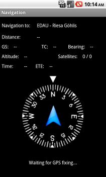
Die App hat auch eine Navigationsfunktion zum ausgewählten Flugplatz und die Möglichkeit den Flug zu speichern und als .IGC-Datei per E-Mail zu versenden.
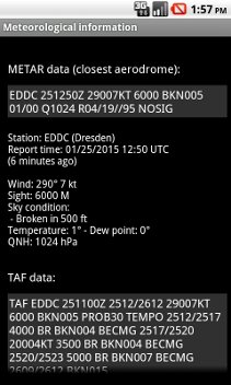
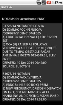
Es gibt auch die Möglichkeit die METAR- und TAF-Daten des ausgewählten Flugplatzes, bzw. eines kontrollierten Flugplatzes in einem 50Km-Radius anzuzeigen, sowie die eventuelle NOTAMs des ausgewählten Flugplatzes.
AirportInfo ist gerade in der Version 1.0-20210930-1 unter der Bedingungen der GPL 2.0 Lizenz verfügbar (Quellcode wird auf Anfrage geschickt).

HERUNTERLADEN
Bildergalerie:
  • Startfenster
  • Hauptmenü
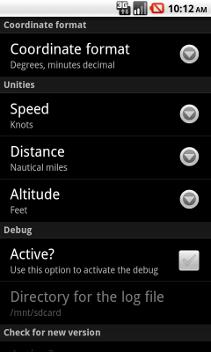
  • Einstellungen
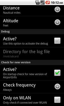
  • Einstellungen
  • Suche eines Flugplatzes
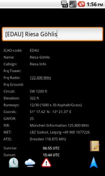
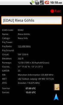
  • Anzeige der Flugplatzdaten
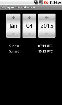
  • Anzeige der Sonnenaufgang und -untergang an ausgewählten Datum
  • Anzeige der METAR- und TAF-Daten
  • Anzeige der NOTAMs
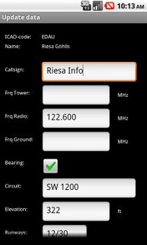
  • Korrektur der Daten eines Flugplatzes
  • Navigation - Warte auf GPS
  • Navigation
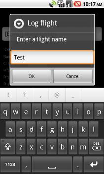
  • Flug speichern
  • Flug speichern
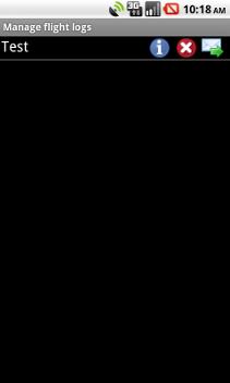
  • Verwaltung der gespeicherten Flüge
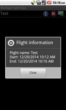
  • Informationen über einem Flug
  • Informationen über die App
Der Inhalt dieser Seiten, sowie die Bilder, sind Eigentum von Luca Bertoncello.
Jede Nutzung und Kopie, auch teilweise, ist nur mit schriftlicher Genehmigung des Autors gestattet.
  • Pages
    • Start page
    • Information about me
    • Read my curriculum
    • My programs
    • IPv6 with Virtuozzo
    • My trumpet
    • myMVC: PHP-Framework
    • MyBackup - Backup for Android
    • AirportInfo - THE App for pilots
    • SimpleVFR - Navigation App
    • PilotWatch - Watchface for pilots
AirportInfo is an Android-App with all data of german (and some international) aerodromes for pilots.
AIP-data and sunrise/sunset will be displayed.
The App has a navigation function to the choosed aerodrome, too and a function to save the flight and send it per E-Mail as .IGC file.
It's possible to get the METAR and TAF data for the selected aerodrome or for a controlled aerodrome in a 50Km radius and the NOTAMs of the selected aerodrome.
The currently App's version is 1.0-20210930-1 and is available under the terms of the GPL 2.0 license (source code will be sent on request).

DOWNLOAD
Screenshots:
  • Main window
  • Main menu
  • Settings
  • Settings
  • Searching aerodromes
  • Displaying data of aerodrome
  • Displaying sunrise and sunset on choosed date
  • Displaying METAR and TAF data
  • Displaying NOTAMs
  • Changing aerodrome's data
  • Navigation - waiting for GPS
  • Navigation
  • Flight log
  • Flight log
  • Managing saved flights
  • Information about a flight
  • Information about the App
The content and the images of these pages are property of Luca Bertoncello.
Every use and copy, also partially, is only allowed with a written permission of the author.
  • Pagine
    • Pagina principale
    • Informazioni su di me
    • Leggi il mio curriculum
    • I miei programmi
    • IPv6 con Virtuozzo
    • Volo su aerei ultraleggeri
    • Il mio Ricettario
    • Il mio Robot
    • La mia sveglia
    • La mia tromba
    • myMVC: Framework PHP
    • MyBackup - Backup per Android
    • AirportInfo - LA App per i piloti
    • SimpleVFR - App per la navigazione
    • PilotWatch - Quadrante per SmartWatch per piloti
AirportInfo è una App per Android che contiene tutti i dati per i piloti delle aviosuperfici tedesche (e qualcuna internazionale).
Oltre ai dati AIP vengono visualizzate le ore di alba e tramonto.
L'App ha anche una funzione per navigare fino all'aviosuperficie prescelta e per salvare il volo e spedirlo via E-Mail in formato IGC.
È possibile anche visualizzare i dati METAR e TAF dell'aerosuperficie selezionata o di un aeroporto controllato in un raggio di 50Km, nonchè gli eventuali NOTAMs dell'aeroporto selezionato.
AirportInfo è attualmente disponibile nella versione 1.0-20210930-1 alle condizioni della licenza GPL 2.0 (il codice sorgente verrà spedito a richiesta).

SCARICA
Schermate del programma:
  • Finestra principale
  • Menu principale
  • Impostazioni
  • Impostazioni
  • Ricerca degli aeroporti
  • Dati dell'aeroporto
  • Alba e tramonto per una data a scelta
  • Dati METAR e TAF dell'aeroporto
  • NOTAMs dell'aeroporto
  • Correzione dei dati dell'aeroporto
  • Navigazione - Attesa del segnale GPS
  • Navigazione
  • Salvataggio del volo
  • Salvataggio del volo
  • Gestione dei voli salvati
  • Informazioni su un volo
  • Informazioni sulla App
I contenuti di queste pagine, così come le foto, sono proprietà di Luca Bertoncello.
Ogni riproduzione, anche parziale, senza un consenso scritto dell'autore è vietata.